
GOOGLE EARTH WORLD’S SIXTH BIGGEST ECONOMY
Virtual world covers two-thirds of the 'real' world
- Dateline
- 7 June 2017
Google Earth’s virtual online buildings, designed and built by the in-world residents, now cover most of the developed world and all major tourism destinations. The annual value of e-commerce and online financial services makes it the planet’s sixth biggest economy.
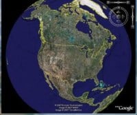
Google’s 3D view of the world, using satellite imagery, was too big to turn into a detailed representation of every building and feature of the planet – but not for the millions of internet users around the world who provide local information in intimate detail.
Business owners populate their virtual offices and stores right there in Google Earth where their real store is located, and customers ‘teleport’ in from Second Life, or just from their living rooms.
This explosive growth in virtual commerce has even been investigated by the FBI, but has grown globally to eclipse California in economic value.
Whether it’s real estate, development aid, disaster relief, international business deals, or just plain shopping – you can find it all on Google Earth.
ANALYSIS >> SYNTHESIS: How this scenario came to be
Building a virtual economic skin
It’s a simple but quite brilliant concept.
When Google launched Earth, their 3D view of the world, using satellite imagery, they wanted to capitalize on local features and attractions to boost their advertising channels. But they soon realized it was too big a task for one company, so they turned it over to the users. With free software tools and lots of encouragement, Google soon had millions of internet users around the world providing local information in intimate detail – and even rendering it as a layer on their Google Earth environment.
Google Earth already has many large city features like the Empire State Building in full 3D. Now, using SketchUp, advanced users can add real or imagined buildings and artefacts to the terrain of Google Earth. You can also provide pictures and local mapping information to enhance the detail at a local level. It’s like a Wikipedia for Earth.
The really interesting bit comes with creative use of the platform. Say you want to develop some coastal land. Simply sketch it up and position your development right there in the landscape. Prospective customers and planning authorities will be able to take a virtual tour of your resort, on-site and mapped to the terrain, before the plans are even approved.
How about a virtual Da Vinci Code tour? You could visit the actual sites and buildings, tour the journey and look at the paintings and memorials just as they really are. What about chatting to other tourists, or their avatars at least? It’s a small jump to buying souvenirs at the virtual gift stores on your way, or booking the actual tour at the virtual travel agent.
Once Google Earth allows an immersive environment, complete with avatars, the potential for local-based virtual commerce becomes explosive. And with regular NASA updates, and even web-cams at strategic points, the virtual world of Google Earth could mimic the real world so closely, it might be difficult to tell which one you’re in!
Links to related stories
- Peek at The Plans For Google Earth - Internetnews.com 2 March 2007
- MTV goes '4D' with virtual-worlds push - CNET News 29 March 2007
- Learning to market in virtual worlds - CNET News 27 March 2007
- MindBullet: VIRTUAL REALITY GEARS UP E-COMMERCE BOOM (Dateline: 1 July 2012, Published: 11 August 2005)
- MindBullet: WHICH ONE IS THE REAL ME? (Dateline: 17 September 2014, Published: 05 October 2006)
- MindBullet: BIG GOOGLE IS WATCHING YOU (Dateline: 19 April 2008, Published: 09 November 2006)
Warning: Hazardous thinking at work
Despite appearances to the contrary, Futureworld cannot and does not predict the future. Our Mindbullets scenarios are fictitious and designed purely to explore possible futures, challenge and stimulate strategic thinking. Use these at your own risk. Any reference to actual people, entities or events is entirely allegorical. Copyright Futureworld International Limited. Reproduction or distribution permitted only with recognition of Copyright and the inclusion of this disclaimer.